

map
This block is part of the google maps group and was last modified in core v11.2.5.
map v11.2.5 Basic map
- Token required
valueEnter the google maps token
- Latitude required
numberThe default center latitude location.
- Longitude required
numberThe default center longitude location
- Zoom required
numberThe default zoom level
- Map type
valueThe type of map to display.
- Default UI
conditionWhen false, the default controls are hidden.
- Cluster Markers
conditionWhen true, all the markers on the map will be clustered together if they are close enough together.
- Cluster Max Zoom
numberWhen fully zoomed out max zoom is the amount of zoom levels you can zoom in on the map (so 20 is 20 clicks on the +)
- Cluster Grid Size
numberThe grid size of a cluster in pixels.
- Cluster icons
arrayAn Array with MAX 5 images for the cluster icons. Items in array needs to be Array with values. IMAGES NEEDS TO BE SMALLER THAN 100PX
- Cluster Text Color
valueColor of the cluster text
- Cluster Text Size
numberSize of the cluster text
- Draggable
conditionWhen false, you will not be able to drag the map.
- Map Type Control
conditionWhen false, you will not be able to toggle between map types • Hidden when other fields are filled
- StreetView Control
conditionHidden when other fields are filled
- Zoom Control
conditionHidden when other fields are filled
- Use scrollwheel
conditionHidden when other fields are filled
- Background Color
valueThis color will be visible when tiles have not yet loaded as the user pans.
- Cluster icons width
numberSet the width of the images • Shown when 'cluster-icons' is filled
- Cluster icons height
numberSet the height of the images • Shown when 'cluster-icons' is filled
- uicomponent
uicomponent
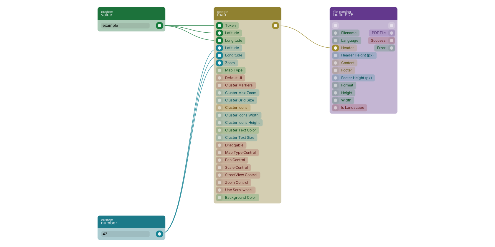
A typical wiring for map: value feeds the co-token pin; value feeds the co-latitude pin; value feeds the co-longitude pin; number feeds the latitude pin; number feeds the longitude pin; number feeds the co-zoom pin; the uicomponent out pin feeds build PDF.
Version history
Introduced in v11.2.5.
Back to
google maps Return to the main group to view all sub-groups Back to google Return to the group to view all blocks within this group